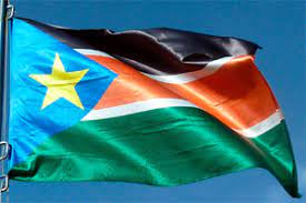
Here in this article, we looked at the states of South Sudan, brief history of its creation and further more we listed the states and area.
The States of South Sudan were created out of the three historic former provinces (and contemporary regions) of Bahr el Ghazal (northwest), Equatorial (southern), and Greater Upper Nile (northeast). The states are further divided into 79 counties.
Read: POLITICAL HISTORY OF SOUTH SUDAN
In October 2015, South Sudan’s President Salva Kiir Mayardit issued a decree establishing 28 states in place of the 10 that was previously established. The decree established the new states largely along ethnic lines. A number of opposition parties challenged the constitutionality of this decree and the decree was referred to parliament for approval as a constitutional amendment. In November, the South Sudanese parliament approved the creation of the new states. In January 2017, President Salva Kiir stated a decreed of further subdivision of the country from 28 into 32 states.
In February 2020, as a result of a peace agreement that ended the South Sudanese Civil War, the country returned to the original 10 states plus two administrative areas, Greater Pibor and Ruweng, and the special administrative status area of Abyei.
As a result of the Comprehensive Peace Agreement signed in 2005, the Abyei Area is considered to be simultaneously part of the Republic of Sudan and the Republic of South Sudan, effectively a condominium. The Kafia Kingi area is disputed between South Sudan and Sudan and the Ilemi Triangle is disputed between South Sudan and Kenya.
TEN STATES AND THREE AREAS (2020–PRESENT)
Under the terms of a peace agreement signed on 22 February 2020, South Sudan is divided into ten states, two administrative areas and one area with special administrative status.[8] The states and administrative areas are grouped into the three former historical provinces of the Sudan: Bahr el Ghazal, Equatoria, Greater Upper Nile. Each state is headed by a Governor and administrative areas are led by Chief Administrators.
| State or area | Capital | Governor or Chief Administrator | Population (2010) | Area (km2) | Density (/km2) | Region | |
| Aweil | Tong Aken Ngor | 820,834 | 30,543.30 | 26.87 | Bahr el Ghazal | ||
| Wau | Sarah Cleto Rial | 358,692 | 91,075.95 | 3.94 | Bahr el Ghazal | ||
| Rumbek | Rin Tueny Mabor | 782,504 | 43,595.08 | 17.95 | Bahr el Ghazal | ||
| Kuajok | Aleu Ayieny Aleu | 1,044,217 | 45,567.24 | 22.92 | Bahr el Ghazal | ||
| Yambio | Alfred Futiyu | 658,863 | 79,342.66 | 8.30 | Equatoria | ||
| Juba | Emmanuel Adil Anthony | 1,193,130 | 43,033.00 | 27.73 | Equatoria | ||
| Torit | Louis Lobong Lojore | 962,719 | 73,472.01 | 13.10 | Equatoria | ||
| Bor | Denay Jock Chagor | 1,228,824 | 80,926.00 | TBD | Greater Upper Nile | ||
| Bentiu | Joseph Monytuil | 399,105 | TBD | TBD | Greater Upper Nile | ||
| Malakal | Budhok Ayang Kur | 1,013,629 | 77,283.42 | 13.12 | Greater Upper Nile | ||
| Abyei | Kuol Deim Kuol | 124,390 | 10,546.00 | TBD | Bahr el Ghazal | ||
| Pibor | Lokali Amae Bullen | 214,676 | 41,962.00 | TBD | Greater Upper Nile | ||
| Pariang | Stefano Wieu Mialek | 246,360 | TBD | TBD | Greater Upper Nile | ||
